

The Future of Smart Utility Mapping in Australia
Construction in Australia is changing fast.
So is the ground information that supports it.
For years, many projects have relied on a mix of old service drawings, patchy records, site assumptions, and late-stage locating. That approach no longer holds up well on busy civil and construction sites. Underground networks are denser. Project pressure is higher. And the cost of getting it wrong keeps rising.
That is why smart utility mapping is becoming more important across Australia.
It is not just about finding buried assets. It is about building a clearer, live picture of what sits below ground, then using that information to plan safer, reduce waste, protect the environment, and improve project performance over time.
In this article, we will look at where smart utility mapping is heading next and why that matters for Australian project managers.
What smart utility mapping means today
Traditional utility mapping usually gives you a static output.
You get plans, marks on the ground, and maybe a report.
Useful, yes. But limited.
Smart utility mapping goes further.
It brings together field detection, digital modelling, live data, and better visual tools so project teams can make stronger decisions before and during excavation. Instead of treating underground information as a one-off task, it turns that information into a working project asset.
In practical terms, smart utility mapping may include:
- GPR and EML data capture
- GPS and GIS positioning
- 3D utility models
- Cloud-based project access
- Real-time data updates
- Asset confidence ratings
- Integrated design and construction workflows
Quick summary: Smart utility mapping turns underground data into a live, usable system instead of a static drawing set.
Why Australia is moving beyond traditional 2D plans
Two-dimensional plans still have a place.
But they do not tell the full story.
And that gap creates risk.
A 2D drawing may show approximate service locations, but it often cannot show enough depth, context, or confidence to support high-risk excavation. On complex sites, that can lead to poor decisions, rework, delays, and asset strikes.
Australian projects are now dealing with:
- Denser utility corridors
- More urban infill work
- Older underground infrastructure
- Incomplete historical records
- Higher compliance expectations
- Greater safety and environmental pressure
That is pushing the industry toward intelligent 3D utility models.
A 3D model helps teams understand where assets sit in relation to each other, nearby structures, excavation zones, drainage lines, and future works. It gives project managers a more realistic view of underground conditions before machines arrive on site.
Quick summary: 2D plans show part of the picture. Intelligent 3D models give teams better context, better planning, and fewer surprises.
The rise of intelligent 3D models in construction and civil works
The shift to 3D is not just a design trend.
It is a risk control.
It is also a project performance tool.
When utility mapping data is built into an intelligent 3D environment, teams can test clashes earlier, review excavation sequences, and coordinate works more clearly across disciplines. This matters on projects where buried services sit close to drainage, transport assets, electrical infrastructure, and live works.
A well-built 3D utility model can help teams:
- Visualise buried asset depth and alignment
- Identify likely clashes before excavation
- Plan safer trenching and potholing
- Improve staging for high-risk work areas
- Reduce over-dig and redesign
- Support clearer pre-start briefings
- Improve contractor coordination
This is especially useful on major civil projects, subdivisions, urban upgrades, and infrastructure renewals, where underground uncertainty often drives delay.
Quick summary: Intelligent 3D models make underground conditions easier to understand, easier to explain, and easier to manage.
How AI is changing utility mapping
Artificial intelligence is starting to reshape utility mapping in a practical way.
Not as hype.
As a decision-support tool.
AI can help process large volumes of subsurface data faster than traditional manual methods alone. It can identify patterns, flag inconsistencies, compare historical records with field data, and support better interpretation of complex site conditions.
In the future, AI-driven utility mapping may help with:
- Automated anomaly detection in scan data
- Faster interpretation of GPR outputs
- Confidence scoring for mapped assets
- Predictive modelling of likely utility paths
- Cross-checking field data against existing records
- Highlighting areas that need further verification
This does not replace skilled operators or experienced project judgement. It strengthens both.
For Australian construction project managers, the value is simple. Better data review means better planning, fewer blind spots, and faster escalation of underground risk before it affects the programme.
Quick summary: AI will not replace utility mapping teams, but it will help them deliver faster, clearer, and more useful underground insights.
Digital twins are set to become a major advantage
A digital twin is a digital version of a real asset or environment.
In utility mapping, that idea is powerful.
It brings underground data to life over time.
Instead of treating mapping as a snapshot taken before excavation, digital twins allow teams to build an ongoing representation of underground conditions that can be updated as works progress. This gives owners, designers, contractors, and maintenance teams a stronger long-term record of what was found, changed, installed, or verified.
For civil and infrastructure projects, digital twins can support:
- Better planning across the full asset lifecycle
- Stronger coordination between design and delivery teams
- Easier updates after service relocation or verification
- More accurate maintenance planning
- Improved handover records
- Reduced reliance on outdated drawings
The long-term value is hard to ignore.
Projects do not end at practical completion.
Assets need to be managed for years.
Digital twins help create a clearer chain between what was detected, what was built, and what needs to be maintained later.
Quick summary: Digital twins turn utility mapping from a pre-construction task into a long-term operational asset.
Augmented reality will change how teams use underground data on site
One of the biggest limits of traditional plans is usability in the field.
A drawing in the ute or site office only goes so far.
Teams need faster, clearer visibility where the work happens.
That is where augmented reality, or AR, is likely to make a real difference.
AR tools can overlay mapped underground services onto a live site view through tablets, phones, or wearable devices. That helps supervisors, operators, and crews understand underground risk in a more direct way before excavation begins.
Possible benefits of AR on Australian sites include:
- Easier visualisation of buried assets in the field
- Better pre-start communication
- Faster identification of high-risk dig zones
- Improved service awareness for machine operators
- Stronger coordination during verification work
- Reduced misreading of complex plans
AR will not remove the need for safe excavation procedures. But it can make underground information much easier to understand under site pressure.
Quick summary: AR can help turn underground mapping into something crews can actually see, not just interpret from paper or screens.
Real-time data integration is the next big shift
The future of utility mapping is not only about better capture.
It is about better connection.
That is where real-time data integration matters.
When utility mapping data connects with project management systems, GIS platforms, machine control, survey data, and field updates, teams can work from a more current version of the truth. That reduces the gap between discovery and decision-making.
Real-time integration can support:
- Faster updates when services are verified
- Better communication between field and office teams
- More accurate staging changes during construction
- Earlier warning of underground conflicts
- Stronger records for design revisions
- Better control of changing site conditions
This matters because underground information often changes during delivery. If a project finds undocumented services, relocates assets, or verifies unexpected alignments, that information should not sit in disconnected files.
Quick summary: Real-time integration helps utility mapping stay current, useful, and aligned with actual site conditions.
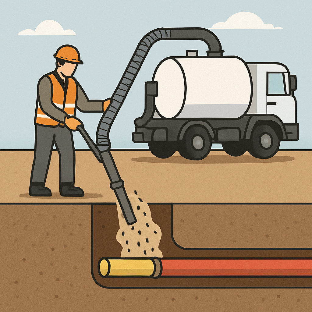
GPR and EML are also advancing
Smart utility mapping still relies on strong field detection.
The tools matter.
So does how they evolve.
Ground Penetrating Radar and Electromagnetic Locating remain core methods across Australian utility locating. Both are improving through better hardware, stronger software, and more refined interpretation workflows.
GPR is becoming more capable
GPR is already useful for locating non-metallic assets, unknown objects, and subsurface changes. Newer systems are improving depth interpretation, data clarity, and scan efficiency.
That can help teams with:
- Better identification of non-metallic pipes
- Clearer subsurface anomaly review
- Faster scan processing
- Improved integration with 3D models
- Stronger mapping confidence in complex areas
EML remains essential for conductive assets
EML continues to play a major role in tracing conductive services such as cables, metallic pipelines, and tracer wire systems. As systems improve, operators can trace more accurately and feed that information into smarter mapping platforms.
The future is in combining methods
The best results will still come from layered detection.
No single method solves every problem.
That will not change.
Smart utility mapping depends on combining GPR, EML, survey control, field verification, and digital modelling in one clear workflow.
Quick summary: The future of mapping is digital, but it still starts with strong field detection and smarter use of GPR and EML.
Why AS5488 will matter even more
As underground information becomes more detailed, standards become more important.
That is where AS5488 stays central.
It gives structure to utility data quality in Australia.
AS5488 provides a framework for classifying the quality of subsurface utility information. It helps teams understand how utility data was obtained and how much confidence they should place in it.
That matters because not all mapped services carry the same certainty.
In a smart mapping environment, AS5488 can help:
- Set expectations around data quality
- Support more defensible planning decisions
- Improve communication between consultants and contractors
- Reduce false confidence in incomplete records
- Strengthen utility risk management during design and delivery
As digital models become more advanced, the need to show data confidence clearly becomes even more important. A polished 3D model is only useful if teams understand how reliable the underlying data is.
Quick summary: AS5488 helps ensure smart utility mapping stays credible, not just visually impressive.
Underground asset protection will drive adoption
For most project managers, the main issue is simple.
Can we avoid hitting services?
Can we keep the job moving?
Smart utility mapping helps answer both questions.
When teams have better underground visibility, they can protect high-risk assets earlier, plan verification more carefully, and reduce the chance of expensive service strikes. This protects more than infrastructure. It protects schedule, budget, safety performance, and client trust.
Underground asset protection improves when teams can:
- See risk zones clearly
- Understand service depth and alignment better
- Identify likely conflicts before excavation
- Brief crews using current data
- Update models as verification progresses
- Coordinate excavation around live assets
That is why smart utility mapping is not just a technical upgrade. It is a practical way to reduce project disruption.
Quick summary: Better utility mapping protects buried assets and helps prevent the delays and costs that follow asset strikes.
Safety outcomes will improve with smarter mapping
Safety and underground visibility go hand in hand.
The less you know below ground, the more risk you carry above it.
Smart utility mapping supports safer excavation because it reduces uncertainty before digging starts. It also improves how that risk is explained to field teams.
This can strengthen safety by supporting:
- Better excavation planning
- Safer potholing and verification
- Clearer exclusion zones
- Stronger machine operator awareness
- Reduced emergency shutdowns
- Better control in congested service corridors
For project managers, this is not only about avoiding incidents. It is about giving teams the right information early enough to work with confidence.
Quick summary: Smarter mapping improves safety by reducing underground uncertainty before it becomes a site incident.
Cost reduction will come from fewer surprises
Underground surprises are expensive.
They stop work fast.
They also keep costing long after the first issue appears.
Smart utility mapping helps reduce costs because it supports earlier decisions, cleaner sequencing, and fewer reactive changes once work starts. Projects that understand underground conditions better tend to spend less on rework, redesign, shutdowns, and emergency response.
Cost benefits often include:
- Fewer asset strike repairs
- Less programme disruption
- Reduced rework
- Better plant and labour efficiency
- More reliable staging
- Lower remediation and cleanup costs
- Stronger handover records
These gains are not theoretical. They come from avoiding the common problems that poor underground information creates every day.
Quick summary: Better underground data reduces avoidable cost by helping teams prevent disruption instead of paying for it later.
Environmental protection will become a bigger part of utility mapping
Environmental performance is now closely tied to excavation planning.
That link will only get stronger.
Smart utility mapping has a role here too.
A damaged underground asset can trigger more than a repair issue. It can release water, fuel, slurry, sediment, or contaminants into soil, drains, and surrounding work areas. On the wrong site, a single strike can quickly become an environmental event.
Smart utility mapping supports environmental protection by helping teams:
- Avoid damaging buried infrastructure linked to contamination risk
- Reduce unnecessary ground disturbance
- Plan excavation around drainage assets
- Protect sensitive areas before work starts
- Limit spread during verification and recovery work
- Improve documentation when incidents occur
That matters on projects near waterways, industrial areas, fuel handling zones, stormwater infrastructure, and contaminated land.
Quick summary: Better utility mapping supports environmental protection by reducing the underground mistakes that often trigger contamination and runoff problems.
Proactive spill management should be part of future mapping strategies
Spill planning often focuses on storage, bunding, and emergency response.
That is important.
But underground risk belongs in that conversation too.
If a buried service strike can release contaminated water, oily waste, or other pollutants, then utility mapping becomes part of proactive spill management. Smart mapping helps identify where those risks sit and how a spill might spread if excavation goes wrong.
This helps teams plan:
- High-risk work zones
- Drain and pit protection points
- Spill kit placement
- Isolation pathways
- Verification requirements before digging
- Escalation procedures if a service is damaged
For project managers, this approach makes spill planning more practical and site-specific. It moves the focus from reacting after a release to reducing the chance of a release in the first place.
Quick summary: Smart utility mapping strengthens proactive spill management by linking underground risk to real containment planning before excavation begins.
Regulatory compliance will rely more on quality data
Compliance is becoming more evidence-based.
Regulators and clients want proof.
They want to see how risk was assessed and controlled.
Smart utility mapping helps strengthen regulatory compliance by improving traceability. When underground risk data is better captured, classified, updated, and shared, project teams can show a clearer record of the steps taken before excavation.
This supports:
- Better utility risk documentation
- Clearer site decision records
- More defensible excavation planning
- Stronger environmental controls
- Better incident investigation support
- More reliable handover information
For Australian project teams, this matters in both safety and environmental contexts. If a site experiences a strike, spill, or contamination event, the quality of the pre-work records will come under scrutiny.
Quick summary: Better data does not remove compliance pressure, but it puts teams in a much stronger position when that pressure appears.
What Australian construction project managers should do now
You do not need to wait for a fully automated future.
There is plenty you can improve now.
Most gains start with better process.
If you want to prepare for smarter utility mapping, focus on practical steps first:
- Review how your projects currently capture underground data
- Check whether utility information is being updated during delivery
- Align locating outputs with AS5488 quality levels
- Use GPR and EML in a layered way where site risk justifies it
- Push beyond 2D mark-ups where projects are complex
- Improve communication between field teams and digital teams
- Link utility mapping with safety, spill planning, and environmental controls
- Treat underground data as a live project asset, not a one-off report
Project managers who do this well will not just reduce risk. They will improve delivery.
Quick summary: Start by improving the way underground data is captured, classified, shared, and used in daily project decisions.
The road ahead
The future of smart utility mapping in Australia looks more connected, more visual, and more intelligent. AI will help process data faster. Digital twins will improve lifecycle value. Augmented reality will make underground risk easier to see on site. Real-time integration will keep project information current.
At the same time, the basics will still matter.
Strong field detection.
Clear standards.
Practical decision-making.
AS5488, better GPR and EML workflows, intelligent 3D modelling, and stronger environmental planning will all shape the next phase of utility mapping across Australian construction and civil projects.
For project managers, the message is clear.
The future is not just about mapping utilities better.
It is about using underground information more intelligently across the life of the project.
Final thoughts
Smart utility mapping is becoming a core part of safer, cleaner, and more efficient project delivery in Australia. The move from static 2D plans to intelligent 3D models is changing how teams plan excavation, protect underground assets, manage cost, and support compliance.
As AI, digital twins, augmented reality, and real-time data integration become more common, project teams will gain a clearer and more useful view of what sits below ground. That will improve safety, reduce disruption, strengthen environmental protection, and support more proactive spill management.
For Australian construction project managers, that future is already starting. The teams that adapt early will be in a stronger position to manage risk, protect assets, and deliver with greater confidence.


Leave a Reply